Alberta Minister of Affordability and Utilities Releases Map Showing Viewscape Restriction Zones for Renewable Energy Projects
March 26, 2024
In February 2024, the Minister of Affordability and Utilities announced several policy changes to the renewable energy project approval process, which are partially based on an inquiry conducted by the Alberta Utilities Commission (AUC) into the ongoing economic, orderly, and efficient development of electricity generation in Alberta. One of the policy changes included:
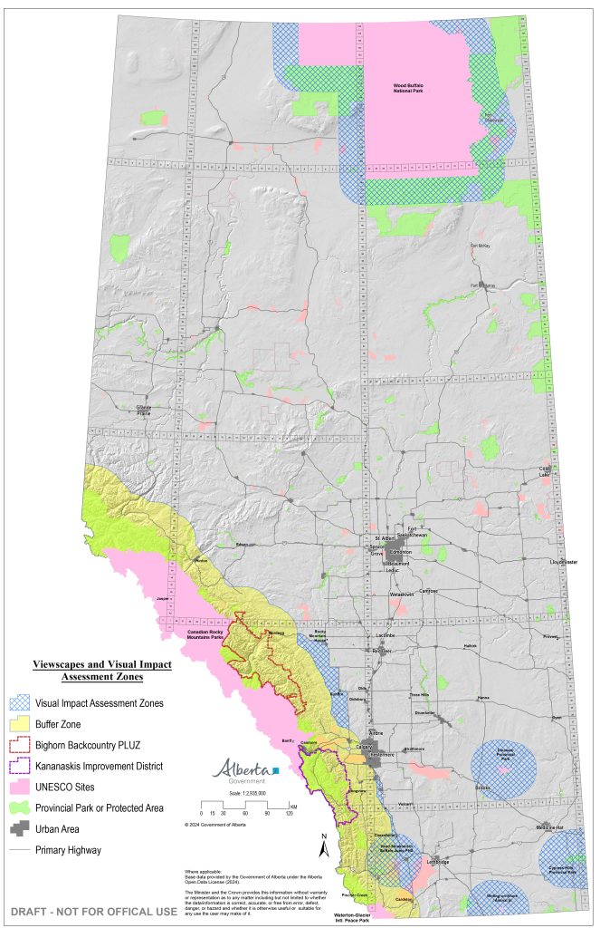
- Buffer zones of 35 kilometres will be established around protected areas and other pristine viewscapes as designated by the province.
The Minister has released a map of the buffer zone, which surrounds the Rocky Mountains and other protected areas. The map also includes “visual impact assessment zones” surrounding some UNESCO Heritage sites and provincial parks, primarily in southern Alberta. Based on the map and information released by the Government of Alberta to this point, it is not clear why some parks and heritage sites are impacted and others are not, and what specifically is required of applicants for projects located within visual impact assessment zones. The RMA is seeking more information on the impacts of buffer zones and visual impact assessment zones.
This article by CBC unpacks the buffer zone map implications with the help of Jason Wang of the Pembina Institute